Thursday, 16 September 2010

Day 16 - Oh What a Beautiful Morning

Day 16   Wednesday 15th September


It was an extremely cold night last night. I got up this morning to a frost on the ground and ice on the outside of the van. However, the usual routine has to be followed and I am ready to set off at about 09.10 on what looks to be a beautiful day. Let’s hope it stays this way. However, before I set off, I thought that I should show what a beautiful day it is with a couple of shots from the Camper Park just outside my van.
Takitimu Mountains from Te Anau Great Lakes Holiday Park
I hadn’t been on the road long; heading back along Highway 94, the way I came yesterday in quite dismal conditions, when I took a couple of pictures of the scene I should have seen yesterday. I think you can spot the amazing difference.
Takitimu Range from SH 94
Just a little further along I turned into yet another site that I had visited yesterday, the ‘Wilderness Scenic Lookout’, and once again the view today is absolutely breathtaking. Apart from these pictures I also spent some time videoing.
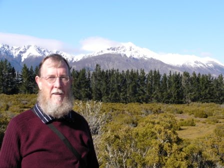
JB at the Wilderness Scenic Lookout - Takitimu Range
JB from the other profile
Compare this with yesterday's photo from Wilderness Lookout
I continued to drift through the countryside at a steady 80 kph (bl**** Sunday drivers!!!) serenaded alternatively by UB40 and Simon and Garfunkel. Well I have an eclectic taste in music apart from the fact that these are the only two CDs I have with me. I decide to get off the State Highway for a while so turned right at Mossburn, heading down country towards Wreys Bush where I would then pick up the SH 96. I was now passing through flat lands where cattle and sheep farming are obviously prevalent, alongside many vineyards. The following pics of the flatlands were taken as I pulled off the SH96 near Winton.
Flat lands near Winton - Takitimu Range in the Background
Near Winton again with Takitimu Range in the distance
I stopped in Winton a short time later and had a stroll around the quite old fashioned town, as can be seen from these shots of a residential property, the Hotel and the Croquet and Bowls Club.
Residential property in Winton - Very Colonial
The Winton Hotel - Established 1889
Winton Croquet and Bowls Club
I also parked outside the town library for a while to have a spot of lunch but, took the opportunity to piggy-back onto their WiFi and logged into the Internet to check my emails. Before anyone protests, this is quite legitimate use of a public service.
 I departed Winton at 13.00 and continued my wandering towards Invercargill but I could see that I was going to be there much earlier than I had anticipated so took another detour to Riverton, a small seaside town about 30 kms to the west of Invercargill. It is a lovely little place with a wide expense of beach as can be seen below:
Riverton Beach
Riverton Beach - But it Was Cold

Although a beautiful day with hardly a cloud in the sky, I still had to wrap up warm in order to go for a stroll along the beach. The wind was extremely chilly.

Following this I continued slowly back towards Invercargill to book into the Lornville Holiday Park, soon after 3.00 pm and took advantage of the rest of a beautiful day with a quiet beer in the garden.

Thankfully, the site was an Internet Hotspot so, was able to log on, check and respond to emails, hold a couple of much valued Skype sessions and then update the Blog for yesterday (14th Sept).

Unfortunately, I came to a bit of grief as I returned to the van to turn in, I somehow managed to misjudge the step up into the van, cracked my head on the lintel, ricked my neck and ended up flat on my back in the gravel. A bit painful, I can tell you but, I don’t think there is any lasting damage. And so to bed said Zebedee.

Wednesday, 15 September 2010

Day 15 - Its Cold as well!!!

Day 15 Tuesday 14th September


Departed from Queenstown after the usual formalities by 09.25, heading for Te Anau which is on the edge of Fiordland and nestling at the foot of the Takitimu mountain range.

I took some more shots of Lake Wakatipu as I travelled South. Looking across the lake I could see the Eyre mountain range as I travelled down and couldn’t resist a few more shots.
Eyre Range looking across Lake Wakatipu
Looking Down Lake Wakatipu towards Kingston

JB at Lake Wakatipu - It was still cold
Reaching the southern tip of the lake I turned into the little village of Kingston when I caught sight of a sign which advertised, ‘The Kingston Flyer’, steam train. Being a bit of a steam engine fan I just couldn’t resist finding out what this was all about. I was astonished to find what seems to be a heritage steam railway and managed to get a number of photos for the scrap book. A couple of which I share with you here. Unfortunately, the site wasn’t operating. Maybe it was too early in the season.
Kingston Flyer Station
One of the Kingston Flyer Engines
The weather was still pretty atrocious but, there were one or two breaks in the cloud and I managed to catch glimpses of what must be amazing scenery. The following couple of shots were taken during such a break, although it was still raining.
It would be very nice in good weather - Takitimu Range
Takitimu Range - Can someone just lift the clouds off!!
Although I had been taking my time, I was still in Te Anau by 2.30 and as the rain had eased off to a slow downpour, I decided to take a quick trip along to Lake Manapouri about 30 kms south. On the way back I diverted from the State Highway, trying to get a little closer to some of the magnificent hills. The following two views were the result. It must be absolutely stunning on a nice day
The Takitimu Range from the Manapouri Road
Takitimu Range from Manapouri Road - Almost a break in the Clouds
On return to Te Anau, I booked into the ‘Great Lakes Holiday Park’ and got myself properly set up. However, the night was turning even colder than usual so spent the evening in the TV Lounge along with other travellers, sat in front of a roaring log fire. I was having great difficulty with the Internet connection but, managed to get the Blog updated for Monday. It was quite a shock having to leave that lovely warm environment and retire to my bitterly cold van, I can tell you. And so to bed said Zebedee.

Tuesday, 14 September 2010

Day 14

Day 14      Monday 13th September


Departed Wanaka camper site at 09.30 taking more pictures of Lake Wanaka as I left. Refuelled at the local Caltex garage and hit the road for Queenstown. The early part of the journey was quite uneventful, following the course f the River Mata and then travelling down the length of Lake Dunstan. However, once past Cromwell the road travelled up the Karawau Gorge and I stopped for photos of Roaring Meg, a tributary which has enough force to power a hydro-electric plant.
Lake Wanaka - early morning

Roaring Meg emptying into the Karawau River


JB at the Karawau River
Further along the Gorge I came to the site of, reputedly, the first commercial bungy jumping site in the world. Don’t know how true that is. Anyway, stopped to have a look and conscious that my travel insurance covered me for one bungy jump. (Yes really!!!)

I managed to get video of a couple who jumped together, must be true love, although she screamed on the way down. However, just standing on the viewing platform looking down into the gorge was giving me half-crown/sixpence feelings. So, at $175 I decided to leave it for another day. (I know – chicken!!!) I decided to treat you to a picture of the area anyway.
The Famous Bridge That People Jump From
Moving quickly on, I arrived in Queenstown by 12.30, found a parking spot for the van and went for a wander about, just to get my bearings. During these wanderings I came across the Kiwi Camper Site so , took the opportunity to book in for the night. I continued my perambulations and ended up at the water front so decided to have a spot of lunch at the cafe of the same name. A very tasty bacon bap which must have contained about half a pound of bacon. So, that filled a little corner.

View from Queenstown Water Front

The Waterfront Cafe & Bar
Having time to spare, I decided to head up the lake to Glenorchy. This is rather like heading up a 45 km cul-de-sac but, the views of the lake and snow capped mountains were well worth the run.


JB at Lake Wakatipu - en route to Glenorchy

View across Lake Wakatipu from Glenorchy

Snow Capped Mountains at Glenorchy

Returning from Glenorchy

View across Lake Wakatipu on returning from Glenorchy
Returned to QT by just after 16.00 so got the van parked up for the night after taking a few more scenic photos of the area. Another busy evening catching up with the other side of the world and then to bed, said Zebedee, by 11.00 pm. A cold night. I could do with someone to keep me warm.
View to the snow capped mountains from the Queenstown camp site

Sunday, 12 September 2010

Days 12 & 13 - Its Raining Again Mother!!!

Day 12   Saturday 11th September


Having decided to stop a second night at the 'Rain Forest Retreat' this morning greeted me with heavy rain so I decided to stay put on the camper site unless the weather cleared up. Call me a wimp, if you like, but there was no way I was going for a 1½ hour hike in the pouring rain. Not just to see a glacier. Its been there for thousands of years it isn't going to go away.
So, I took the opportunity to get caught up with my household chores. I got all my washing done and dried and I got a computer back-up done. This is something I try to get done at least once a week, I would hate to loose all of the photos and video I now have on the laptop.
For those of you who like that sort of thing, here are a few stats about my NZ journey so far:
For those who like them here are a few stats about my New Zealand trip so far:
  • Distance Covered by road = 1449 miles
  • Fuel costs = $456 = £211
  • Cost Per Mile = 15 Pence (approx)
  • Total daily costs = £48
  • Budgeted Cost = £55
  • Saving against budget = £7
  • Result = Happiness (apologies to Charles Dickens and Mr Micawber)
Additionally, I am attaching a couple of maps to indicate the route I have taken from Auckland on North Island and as far as I have got on South Island:

Route on North Island - Shown in blue
Route Down South Island - Shown in Blue
At the end of a quiet day spent waiting for the rain to stop, which it didn’t, I took myself off to the Monsoon Bar (appropriate name at the moment) for a couple of pints of Tui, but had to leave before the rugby match between the Wallabies and the All Blacks had really got going. Apparently the All Blacks won by a single point.

Day 13 Sunday 12th September

Still raining this morning but have to leave anyway. Usual routine but slower due to a lack of motivation (it’s the rain), and hit the road at 09.30. Decided to head down the road to Fox Glacier and hope that the weather improves on the way. The following picture was taken just South of Franz Josef Glacier:
Near the village of Franz Josef Glacier
I arrived in the village of Fox Glacier at about 10.00 but turned off to visit Lake Matheson which is renowned for its tranquil reflection of the peaks of Cook, Tasman and La Perouse. However, today the peaks were totally shrouded in cloud so the following pictures are perhaps no quite as impressive as they might have been. I was quite impressed by the suspension bridge which leads you towards the lake, it bounced quite animatedly as I walked across:
JB at the Suspension Bridge - It sure did bounce
Matheson Lake
Matheson Lake
Following the visit to the lake, during which time the rain had miraculously stopped, I returned to Fox Glacier and headed up the Glacier Access road. Unfortunately, by the time I pulled up in the car park, the heavens had opened again and there was no way I was venturing out. So, took a couple of shots in the car park and departed, under a cloud, literally.

Near to Fox Glacier - In the rain
By this time I had decided that I was not fated to get any closer to the glaciers than I had been on Friday evening so, headed off South in hopes of reaching better weather. The Route 6 highway meanders through the Mount Cook foothills for a time and then briefly touches the coast at Bruce Bay:
Bruce Bay with Spray and Rain
Bruce Bay Pebble Deposits
The pounding sea here was casting up a spindrift that merged with the rain to dramatically reduce visibility.

The road turned back inland and after a bit more climbing brought me to Lake Paringa, well known for its Brown trout and Quinnat salmon.
Lake Paringa
Another half hour and I was once again back on the coast at Knights Point Lookout where there is, apparently a colony of Fiordland penguins. I didn’t see any though. However, the weather was starting to improve a bit.
Knights Point
JB at Knights Point Lookout
Soon afterwards I arrived at Haast and the road swung inland with a vengeance, following the Haast River up into the hills before turning South across the 1,867 ft high Haast Pass over Mount Brewster. The following pictures were taken where the road crosses the Haast river in an area known as the ‘Gates of Haast’.
River Haast at the 'Gates of Haast'
Road Bridge at the Gates of Haast
Once over the pass the road entered an area known as ‘Cameron Flat’, overlooked by the peaks of Mounts Aspiring, Pollux, Castor and Alba.
Cameron Flat
It wasn’t long before I came to the North end of Lake Wanaka, which is one of the lakes in the region created by glacial activity. The scenic lookout provided the following views:
Lake Wanaka
Lake Wanaka
Another of the glacial lakes, Lake Hawea,
Lake Hawea
Lake Hawea
JB at the Lake Hawea Lookout
lies alongside Lake Wanaka and the road crosses from Wanaka to Hawea to skirt the shores of that lake to its southern end when it crosses back over the hill into the town of Wanaka itself.

So after a day,s journey of some 308 kms through some spectacular landscape and some atrocious weather I finally arrived at my watering hole for the evening, the ‘Lakeview Holiday Park’ in Wanaka. It had been a tiring day though and after drafting the Blog update and dealing with a couple of emails, it was time to hit the sack. So Time for Bed said Zebedee.