Saturday 18 September 2010

Day 18 - Slow Down Son

Day 18    Friday 17th September


Well, a bit late up this morning, couldn’t force myself out of the covers until 07.30. After completing the daily chores, I logged on to check my email and found myself in an unexpected Skype session with daughter Samantha. By the time I had finished, I just had time to do the final checks on the van before clearing the site by 09.55.

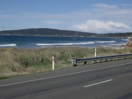
Once again I am heading North up the East coast and it seems much easier to cover distance on this side of the country. Probably because I am not travelling around so many twists and turns, nor climbing so many hills. However, this side of the country still has lots to offer as can be seen from this view at Blue Skin Bay, even though the weather was not very good.
It wasn't quite this dark but it was pretty dismal
I was only about 40 minutes North of Dunedin when I realised that the direct route was going to get me to my destination far too early so, I stopped at Palmerston to re-plan. I took the following photos near Palmerston of a range of hills of unknown name. (Unknown to me anyway)
Hills near Palmerston - Can you make out the lambs?
Same hills - more lambs
Same Hills - Probably the same lambs
Different Hill near Palmerston
I was originally going to stop at Timaru but decided to continue through there and join the Inland Scenic Route and night stop at a place called Geraldine.

A little further up the road I came to Shag Point and was sufficiently impressed with the view that I took the following couple of shots.
View of Shag Point across the bay
Slightly larger view of Shag Point
The driving was quite uneventful and I even had time to actually take in some of the scenery as I travelled along. It was strange to see lambs in the fields at this time of year; if you look carefully you might be able to make some out in the Photos taken near Palmerston. Equally as strange was the sight of daffodils in full bloom. By now though it was time for a spot of lunch so, stopped off at Waitaki Bridge where I took the following shots looking South West towards the Kakanui Mountains.
The Kakanui Hills from the Waitaki River

Same Hills different perspective

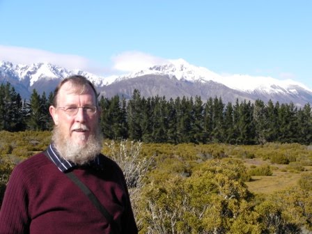
JB at Waitaki - that flash doesn't do a thing for me!
The chef did a sterling job with lunch, a cheese sandwich and a banana washed down with a glass of diet coke. I know how to live the high life. After consuming this resplendent feast I continued with the immediate objective of getting fuel and provisions when I reached Timaru but, on the way took a couple of shots of the Hunter Hills. Also captured some more lambs in these pics.
The Hunter Hills from just north of the Waitaki River

Hunter Hills (and lambs) near Waitaki River
Successfully completed my mission with regard to fuel and provisions but, I have to say that I felt a bit inadequate when getting my few bits and pieces in the Pak N’ Save supermarket. Everyone else looked as though they were shopping to feed an army just going off to war.

However, leaving Timaru I very soon got to Winchester where I turned off onto the Inland Scenic Route, SH 72 which would take me to Geraldine. Just north of the town I took the following shots of what I think are Mounts Taylor and Hutt.
Distant View of Mounts Taylor and Hutt
Mount Taylor
Despite trying to take my time I still managed to arrive at the Geraldine Holiday Park by 3.15 pm so once I had the van established, I set off for a walk around town. It is not a big place, as you can imagine but quaint and well maintained. Almost every town seems to have its own little museum, as seen here; and I couldn’t resist the shot of spring flowers near the river.
Geraldine Town Museum
Spring Flowers by the river in Geraldine
The walkabout didn’t take long and I was back at the Holiday Park in time to get a shot of the enormous tree under which I was parked, (must be 150 ft at least) and one of the amusing art works which were dotted around the site.
My Little Camper Van under the Enormous Tree
Billy No Mates? Holiday Park Art Work
It was then time to check on emails and once again I was able to piggy-back on the public library Internet for a while.

Anyway, I think I have given you enough photos for one day, and these are not all I have taken. The rest being stored on my trusty laptop which, naturally, being Friday, I have backed up to my external hard drive.

By the time I had tea, my usual much valued Skype session and updated the Blog I was a very tired bunny and so to bed said Zebedee.

Friday 17 September 2010

Day 17 - Turning North Again

Day 17 Thursday 16th September


Packed up and ready to hit the road by 09.30, after the usual preparations. My neck is feeling a bit stiff this morning after last night’s little escapade. Must try not to do that again. The night had been warmer than previous but wet and very windy.

Nothing really noteworthy during the first part of the journey today or maybe I’m just getting used to the scenario. I was travelling along the SH 98 to Dacre where I rejoined SH 1 through Edenvale and up to Mataura where I stopped for fuel and provisions. However, shortly after that I stopped to photograph the distant Blue Mountains just to give a example of the difference in terrain I was now travelling through.


The Blue Mountains in the Distance

The Blue Mountains from Waikaka Valley
In fact by the time I go to Gore on SH 1 (Actually called the Presidential Highway presumably because it goes between Gore and Clinton – although I could be wrong) I had decided to turn off on SH 90 which goes through the Blue Mountains and join SH 8 at Raes Junction, where it skirts the southern part of the Lammerlaw Range. Unfortunately, whenever I got the opportunity to stop for photos, the weather had closed in again leaving me with not a lot to see. I drifted down through Lawrence and rejoined the SH 1 (again) at Clarksville for the run up to Dunedin.

Just after Clarendon I turned into a scenic picnic spot at Lake Waihola and I think the following photograph illustrates just how un-inviting the water appeared.
Lake Waihola - It didn't look very inviting to me.
I am sure that it is a delightful and popular place during the summer months but just at the moment it is pretty well closed for business.

Arrived at the ‘Dunedin Holiday Park’ at about 3.30, set up the van and went for a walk to the St Kilda Beach. The following pictures might give you some idea how the wind was lifting the spray from the breaking waves and carrying it right over the dunes. This could be seen from quite some distance.
St Kilda Beach
St Kilda Beach

View of Dunedin from the dunes across the Golf Course
Returned to the van by 16.45 and chilled out for an hour with a beer and a book. It was then down to business with updating the Blog before making contact with my lady friend for an hour long Skype session, although I did manage to have 5 minutes with my sister in Australia beforehand. Then it was early to bed, as Zebedee says.

Thursday 16 September 2010

Day 16 - Oh What a Beautiful Morning

Day 16   Wednesday 15th September


It was an extremely cold night last night. I got up this morning to a frost on the ground and ice on the outside of the van. However, the usual routine has to be followed and I am ready to set off at about 09.10 on what looks to be a beautiful day. Let’s hope it stays this way. However, before I set off, I thought that I should show what a beautiful day it is with a couple of shots from the Camper Park just outside my van.
Takitimu Mountains from Te Anau Great Lakes Holiday Park
I hadn’t been on the road long; heading back along Highway 94, the way I came yesterday in quite dismal conditions, when I took a couple of pictures of the scene I should have seen yesterday. I think you can spot the amazing difference.
Takitimu Range from SH 94
Just a little further along I turned into yet another site that I had visited yesterday, the ‘Wilderness Scenic Lookout’, and once again the view today is absolutely breathtaking. Apart from these pictures I also spent some time videoing.
JB at the Wilderness Scenic Lookout - Takitimu Range
JB from the other profile
Compare this with yesterday's photo from Wilderness Lookout
I continued to drift through the countryside at a steady 80 kph (bl**** Sunday drivers!!!) serenaded alternatively by UB40 and Simon and Garfunkel. Well I have an eclectic taste in music apart from the fact that these are the only two CDs I have with me. I decide to get off the State Highway for a while so turned right at Mossburn, heading down country towards Wreys Bush where I would then pick up the SH 96. I was now passing through flat lands where cattle and sheep farming are obviously prevalent, alongside many vineyards. The following pics of the flatlands were taken as I pulled off the SH96 near Winton.
Flat lands near Winton - Takitimu Range in the Background
Near Winton again with Takitimu Range in the distance
I stopped in Winton a short time later and had a stroll around the quite old fashioned town, as can be seen from these shots of a residential property, the Hotel and the Croquet and Bowls Club.
Residential property in Winton - Very Colonial
The Winton Hotel - Established 1889
Winton Croquet and Bowls Club
I also parked outside the town library for a while to have a spot of lunch but, took the opportunity to piggy-back onto their WiFi and logged into the Internet to check my emails. Before anyone protests, this is quite legitimate use of a public service.
 I departed Winton at 13.00 and continued my wandering towards Invercargill but I could see that I was going to be there much earlier than I had anticipated so took another detour to Riverton, a small seaside town about 30 kms to the west of Invercargill. It is a lovely little place with a wide expense of beach as can be seen below:
Riverton Beach
Riverton Beach - But it Was Cold

Although a beautiful day with hardly a cloud in the sky, I still had to wrap up warm in order to go for a stroll along the beach. The wind was extremely chilly.

Following this I continued slowly back towards Invercargill to book into the Lornville Holiday Park, soon after 3.00 pm and took advantage of the rest of a beautiful day with a quiet beer in the garden.

Thankfully, the site was an Internet Hotspot so, was able to log on, check and respond to emails, hold a couple of much valued Skype sessions and then update the Blog for yesterday (14th Sept).

Unfortunately, I came to a bit of grief as I returned to the van to turn in, I somehow managed to misjudge the step up into the van, cracked my head on the lintel, ricked my neck and ended up flat on my back in the gravel. A bit painful, I can tell you but, I don’t think there is any lasting damage. And so to bed said Zebedee.

Wednesday 15 September 2010

Day 15 - Its Cold as well!!!

Day 15 Tuesday 14th September


Departed from Queenstown after the usual formalities by 09.25, heading for Te Anau which is on the edge of Fiordland and nestling at the foot of the Takitimu mountain range.

I took some more shots of Lake Wakatipu as I travelled South. Looking across the lake I could see the Eyre mountain range as I travelled down and couldn’t resist a few more shots.
Eyre Range looking across Lake Wakatipu
Looking Down Lake Wakatipu towards Kingston

JB at Lake Wakatipu - It was still cold
Reaching the southern tip of the lake I turned into the little village of Kingston when I caught sight of a sign which advertised, ‘The Kingston Flyer’, steam train. Being a bit of a steam engine fan I just couldn’t resist finding out what this was all about. I was astonished to find what seems to be a heritage steam railway and managed to get a number of photos for the scrap book. A couple of which I share with you here. Unfortunately, the site wasn’t operating. Maybe it was too early in the season.
Kingston Flyer Station
One of the Kingston Flyer Engines
The weather was still pretty atrocious but, there were one or two breaks in the cloud and I managed to catch glimpses of what must be amazing scenery. The following couple of shots were taken during such a break, although it was still raining.
It would be very nice in good weather - Takitimu Range
Takitimu Range - Can someone just lift the clouds off!!
Although I had been taking my time, I was still in Te Anau by 2.30 and as the rain had eased off to a slow downpour, I decided to take a quick trip along to Lake Manapouri about 30 kms south. On the way back I diverted from the State Highway, trying to get a little closer to some of the magnificent hills. The following two views were the result. It must be absolutely stunning on a nice day
The Takitimu Range from the Manapouri Road
Takitimu Range from Manapouri Road - Almost a break in the Clouds
On return to Te Anau, I booked into the ‘Great Lakes Holiday Park’ and got myself properly set up. However, the night was turning even colder than usual so spent the evening in the TV Lounge along with other travellers, sat in front of a roaring log fire. I was having great difficulty with the Internet connection but, managed to get the Blog updated for Monday. It was quite a shock having to leave that lovely warm environment and retire to my bitterly cold van, I can tell you. And so to bed said Zebedee.

Tuesday 14 September 2010

Day 14

Day 14      Monday 13th September


Departed Wanaka camper site at 09.30 taking more pictures of Lake Wanaka as I left. Refuelled at the local Caltex garage and hit the road for Queenstown. The early part of the journey was quite uneventful, following the course f the River Mata and then travelling down the length of Lake Dunstan. However, once past Cromwell the road travelled up the Karawau Gorge and I stopped for photos of Roaring Meg, a tributary which has enough force to power a hydro-electric plant.
Lake Wanaka - early morning

Roaring Meg emptying into the Karawau River


JB at the Karawau River
Further along the Gorge I came to the site of, reputedly, the first commercial bungy jumping site in the world. Don’t know how true that is. Anyway, stopped to have a look and conscious that my travel insurance covered me for one bungy jump. (Yes really!!!)

I managed to get video of a couple who jumped together, must be true love, although she screamed on the way down. However, just standing on the viewing platform looking down into the gorge was giving me half-crown/sixpence feelings. So, at $175 I decided to leave it for another day. (I know – chicken!!!) I decided to treat you to a picture of the area anyway.
The Famous Bridge That People Jump From
Moving quickly on, I arrived in Queenstown by 12.30, found a parking spot for the van and went for a wander about, just to get my bearings. During these wanderings I came across the Kiwi Camper Site so , took the opportunity to book in for the night. I continued my perambulations and ended up at the water front so decided to have a spot of lunch at the cafe of the same name. A very tasty bacon bap which must have contained about half a pound of bacon. So, that filled a little corner.

View from Queenstown Water Front

The Waterfront Cafe & Bar
Having time to spare, I decided to head up the lake to Glenorchy. This is rather like heading up a 45 km cul-de-sac but, the views of the lake and snow capped mountains were well worth the run.


JB at Lake Wakatipu - en route to Glenorchy

View across Lake Wakatipu from Glenorchy

Snow Capped Mountains at Glenorchy

Returning from Glenorchy

View across Lake Wakatipu on returning from Glenorchy
Returned to QT by just after 16.00 so got the van parked up for the night after taking a few more scenic photos of the area. Another busy evening catching up with the other side of the world and then to bed, said Zebedee, by 11.00 pm. A cold night. I could do with someone to keep me warm.
View to the snow capped mountains from the Queenstown camp site